1700 Cascadia Earthquake
| Use attributes for filter ! | |
| Magnitude | 8. 7–9. 2 Mw |
|---|---|
| Fault | Cascadia subduction zone |
| Epicenter | 45°N 125°W / 45°N 125°W Coordinates: 45°N 125°W / 45°N 125°W |
| Date of Reg. | |
| Date of Upd. | |
| ID | 1276646 |
About 1700 Cascadia Earthquake
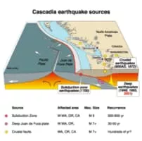
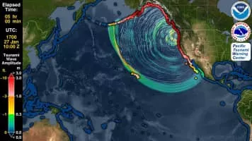
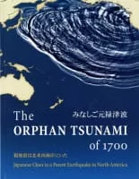
The 1700 Cascadia earthquake occurred along the Cascadia subduction zone on January 26 with an estimated moment magnitude of 8. 7–9. 2. The megathrust earthquake involved the Juan de Fuca Plate from mid-Vancouver Island, south along the Pacific Northwest coast as far as northern California.
1700 Cascadia earthquake Photos